![]()
The Great Pinery Heritage Waterway is an overarching water trail that consist of three rivers located in Central Wisconsin. The Wisconsin River Trail is 108 miles in length starting at the Hat Rapids Dam in Oneida County and ending in Portage County at the Lake DuBay Dam. Portions of the trail hold scenic wonders as it flows over rapids and rock outcropping, through primeval pine and hardwood forest, and along the Ice Age Trail.
The trail beckons us back to a time when the Miami, called the great river, Meskonsing. When European explorers and missionary Father Jacques Marquette entered it in his journal in June 1673 during the voyage, he made by canoe with fur trader Louis Joliet across Wisconsin and down the Mississippi River.
The great river is never far from our imagination, fast flowing, scenic in its northern segments to urban and industrial as it flows south through cities that once had names such as Jenny Falls, Big Bull, and Little Bull Falls. The river has always been a gateway to the north, to the “Great Pinery” the great boreal forest that blanketed the lands to the great lake, the Chippewa called, Gitchi Gami.
In the 1870’s the river earned a new name as the “Hardest Working River in the World” when men with names like Stevens, McIndoe, Barker, and Stewart put the river to work sawing lumber for the cities and homes of the Midwest. In 1907 the Wisconsin Valley Improvement Company was established as a group of private interests to manage and regulate the flow of the Wisconsin River so that hydroelectric energy and the papermaking industry could develop and flourish.
Today, the Wisconsin has returned to its beginnings offering the paddler an adventure not soon forgotten!
Trail Vitals: 108 miles in length with 24 designated landings along its length, two state parks, state, and county forests, six dam portages, primitive camping, wildlife and natural areas, hiking and biking trails that border its banks, amenities galore, historical bridges and dams, Class I-III rapids, adjoining Class I trout streams, and a Frank Lloyd Wright home that graces its banks!
The Lower Big Rib River Trail starts its 17 mile journey in Marathon City at Lions Park as it flows east to join the Wisconsin River at Bluegill Bay Park on Lake Wausau. Joshua Hathaway in his 1839 government survey of the lands bordering the Wisconsin River between Pointe Basse and Big Bull Falls mentioned the Big Rib River for the first time.
The river flows over sand and gravel bars and along heavily wooded banks that give the river an “up north” feeling of seclusion and adventure. Heron, ducks, and deer are common along its banks and the river fails to disappoint the angler for smallmouth and walleye.
Trail Vitals: 17 miles in length with three landings along its length ending at Bluegill Bay Park, a historical bridge, and wildlife viewing
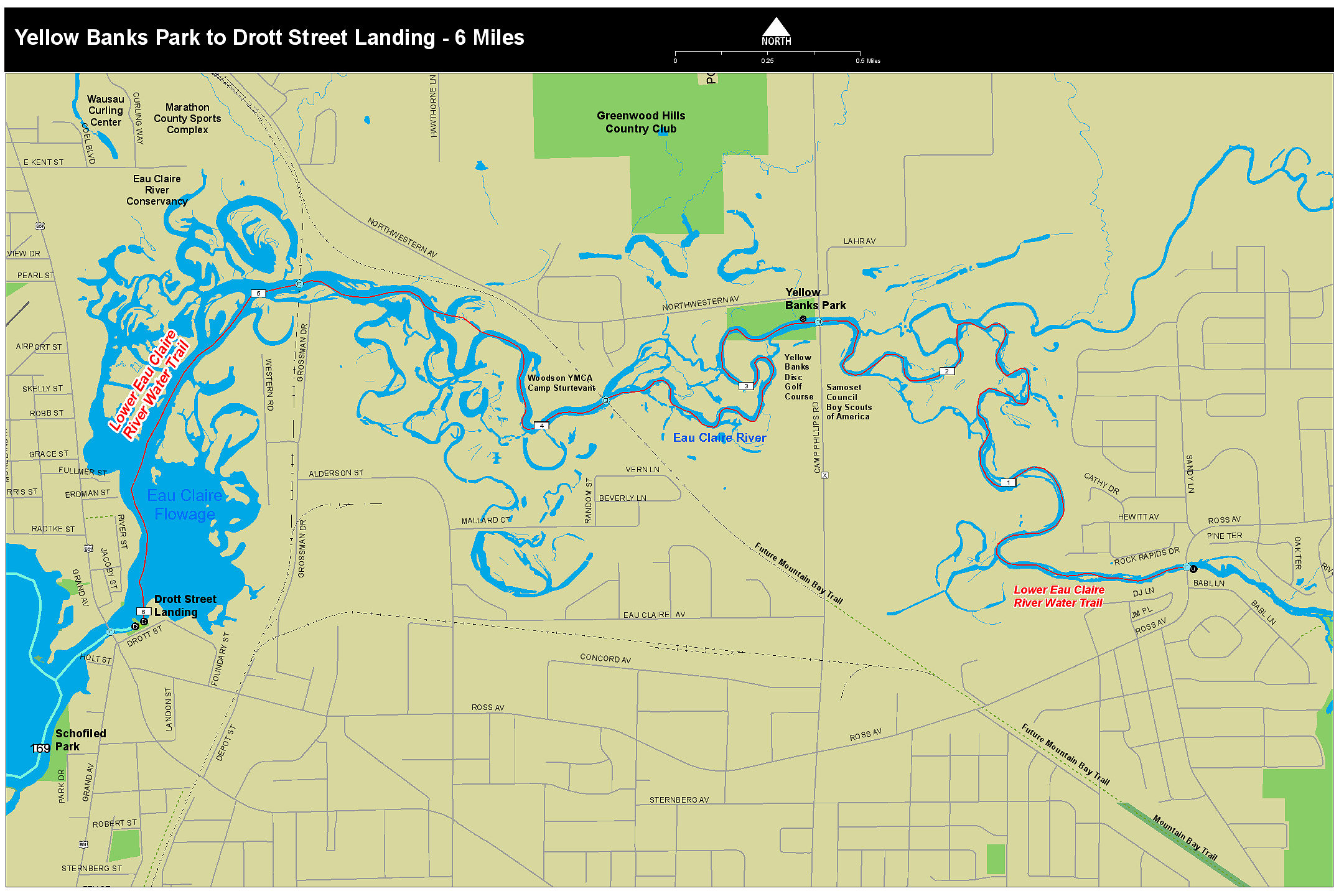
The Lower Eau Claire River Water Trail starts its 15 mile journey at the Clubhouse Road landing on the south side of the bridge and flows through boulder fields, and scenic landscapes before entering Lake Wausau just west of the historic Brooks and Ross dam. The trail passes by historical bridges, flowing through the Eau Claire River Conservancy giving the trail an “everglade” like feeling as one paddles around cattails and reeds before exiting at the Drott Street Landing where once stood one of the first sawmills in the Northwoods and having the claim to fame of cutting one of the largest and oldest white pines in the state, germinating in or around 1500.
Trail Vitals: 15 miles in length with four landings, one dam portage, natural areas, historic bridges and ending in Lake Wausau where it joins the Great Pinery Heritage Waterway.
![]()
Lincoln County Landings / Launches
County A Bridge Boat Landing – Tomahawk
Veteran’s Memorial Park – Tomahawk
SARA Park Boat Landing Tomahawk
Bradley Park Boat Landing – Tomahawk
Tomahawk Dam Boat Landing & Portage
Lincoln County E Bridge Landing / Grandfather Falls Boat Landing
Camp New Wood County Park Boat Landing
Lokemoen Road Boat Landing – Merrill
Alexander Dam Portage – Lincoln County
Council Grounds State Park Boat Landing – Lincoln County
Ott’s Park Boat Landing – Merrill
Riverside Park Boat Landing – Merrill
Marathon County Landings / Launches
Brokaw Mill Boat Landing – Brokaw
Gilbert Park Boat Landing – Wausau
Scholfield Park Boat Landing – Wausau
RiverLife Park – North End – Wausau
RiverLife Park – Wausau Boat Dock – Wausau
Hadley’s Portage at the Wausau Dam – Wausau
Oak Island Park Boat Landing – Wausau
Memorial Park Boat Landing – Wausau
D.C. Everest Park Boat Landing – Wausau
Bluegill Bay Park Boat Landing – Rib Mountain
Radtke Park Canoe & Kayak Launch – Schofield
Kort Street Park Boat Landing – Rothschild
Rothschild Dam Portage & Domtar Public Boat Landing – Rothschild
River Park Boat Landing – Mosinee
Canoe Portage Park Boat Landing & Chuck’s Boat Landing – Mosinee
Lake Dubay Lions Park – Knowlton
Park Road Boat Landing – Mosinee
Lake Du Bay Dam Portage – Dewey
Drott Street Landing & Schofield Dam Portage – (Brooks and Ross Dam) – Schofield
Riverside Park – Marathon City
Little Rib River Landing – Wausau
Gulliver’s Boat Landing – Rib Mountain
Rookery View Park Boat Landing – Rib Mountain
Great Pinery Heritage Waterway Maps
Great Pinery Heritage Waterway Overview Map
Map 1 Hat Rapids to Kings Dam Portage
Map 2 Kings Dam Portage to Tomahawk Dam Portage
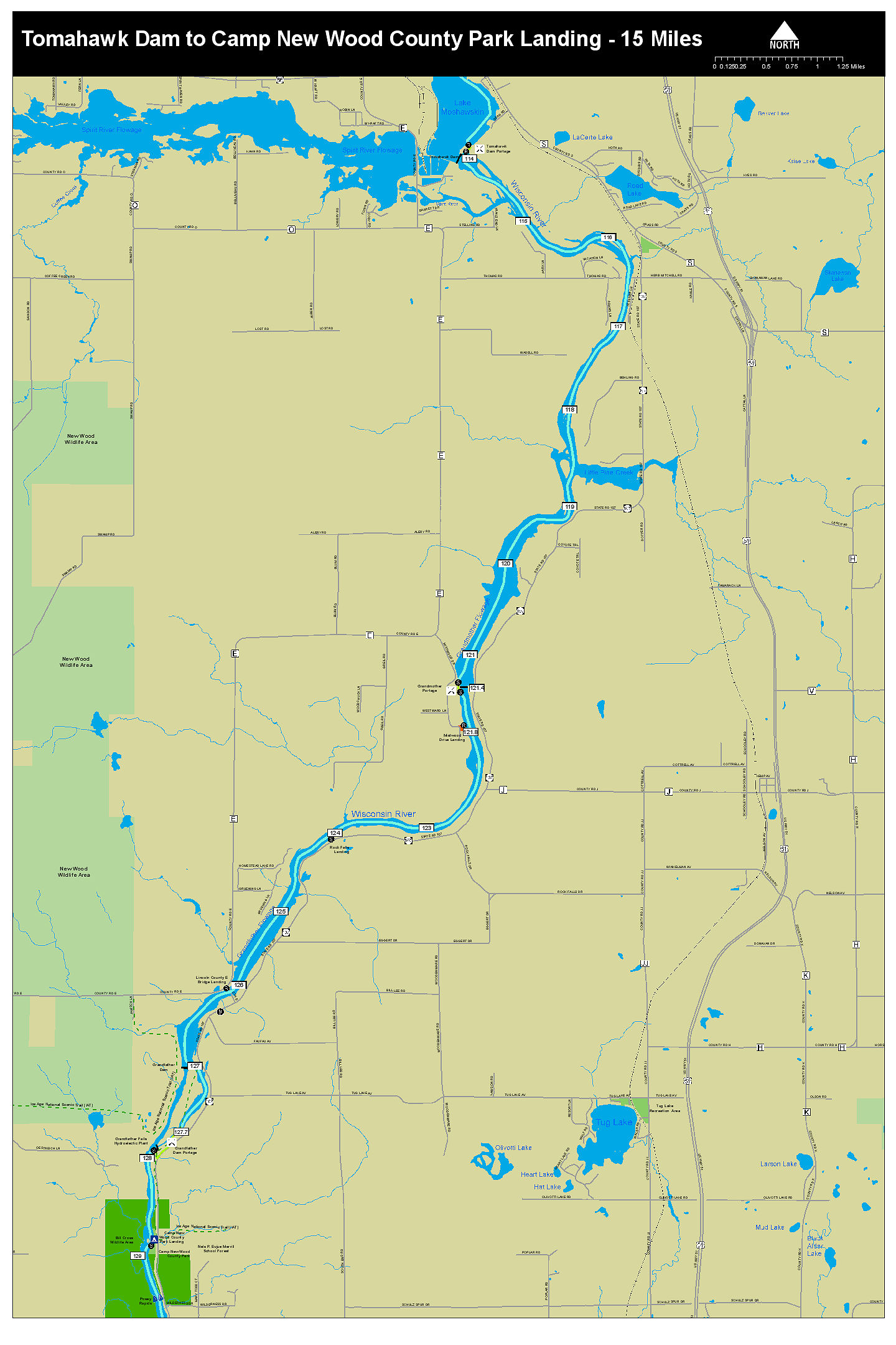
Map 3 Tomahawk Dam Portage to Camp New Wood
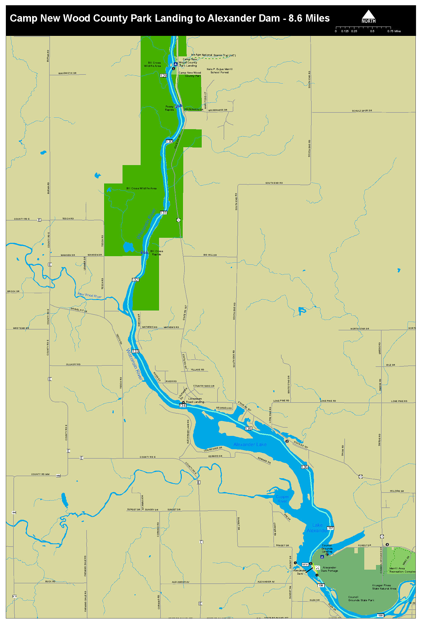
Map 4 Camp New Wood To Alexander Dam Portage
Map 5 Alexander Dam Portage to Merrill Riverside Park
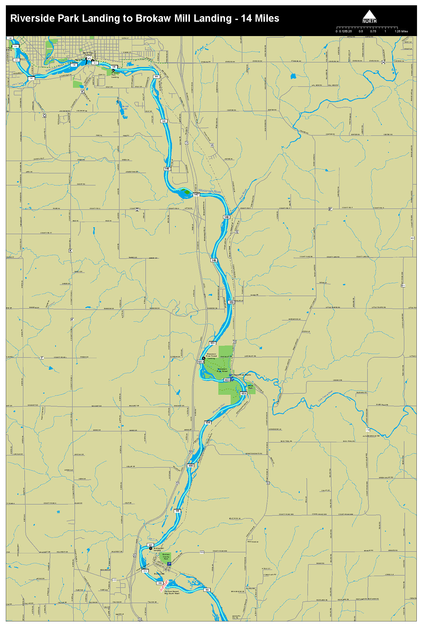
Map 6 Merrill Riverside Park To Brokaw Mill Landing
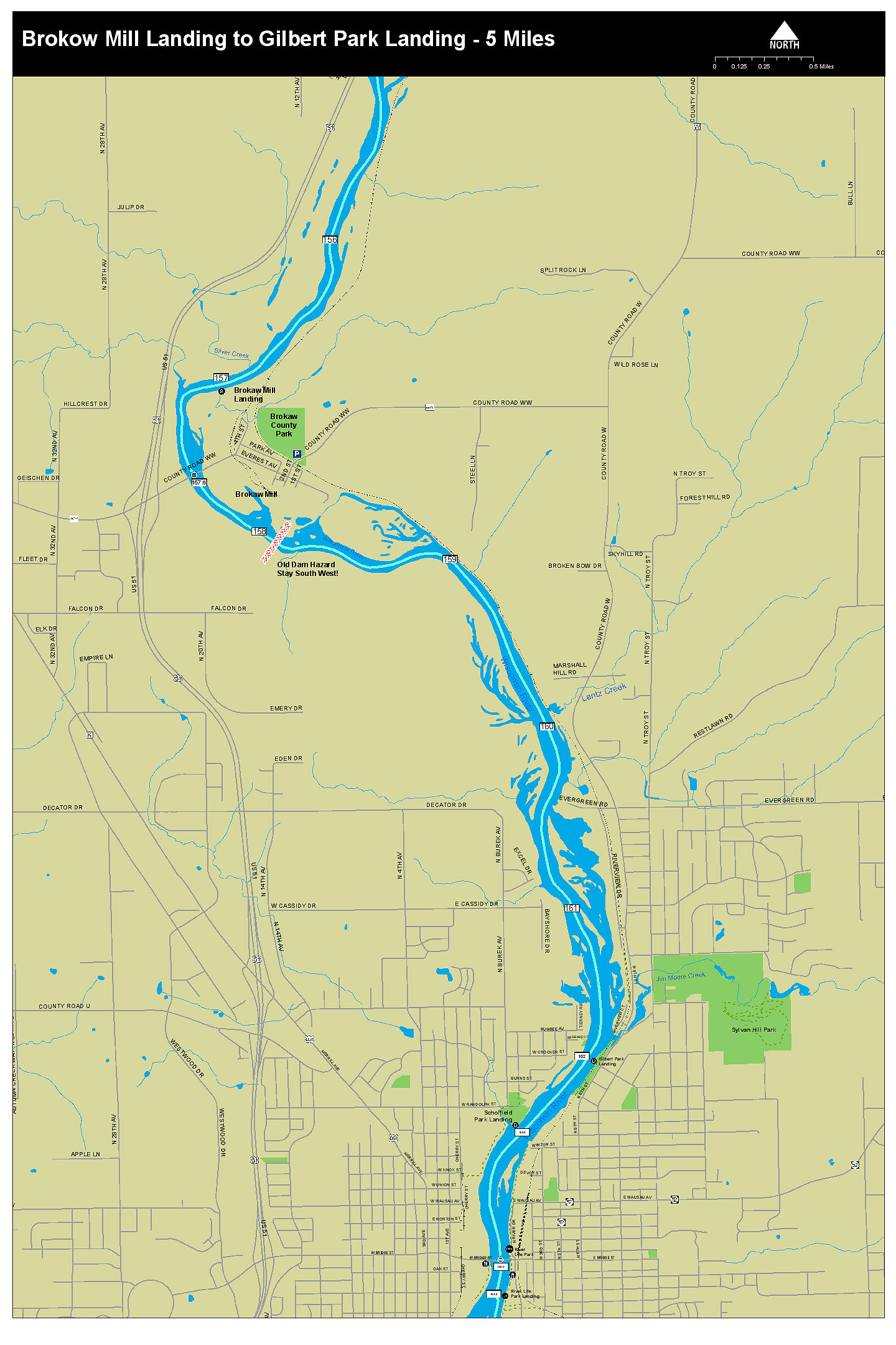
Map 7 Brokaw Mill Landing to Gilbert Park Landing
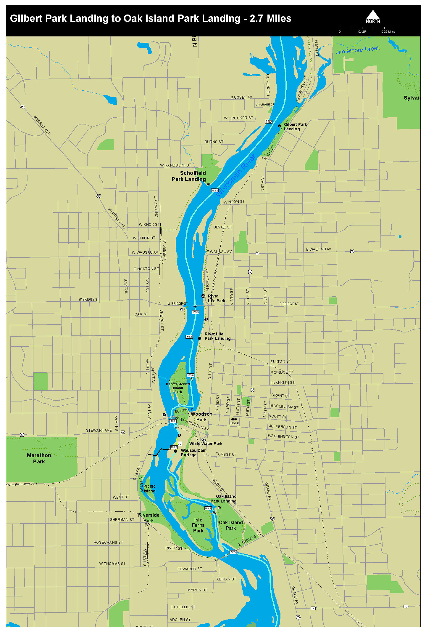
Map 8 Gilbert Park Landing to Oak Island Park Landing
Map 9 Oak Island Park Landing to Rothschild Dam Portage
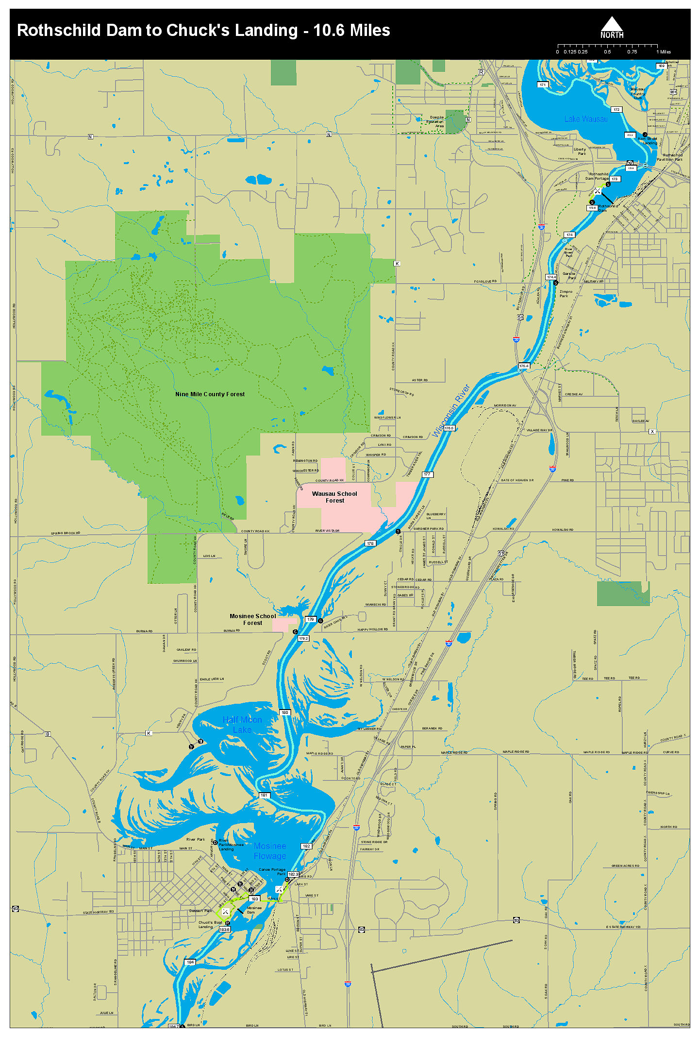
Map 10 Rothschild Dam Portage to Chucks Landing
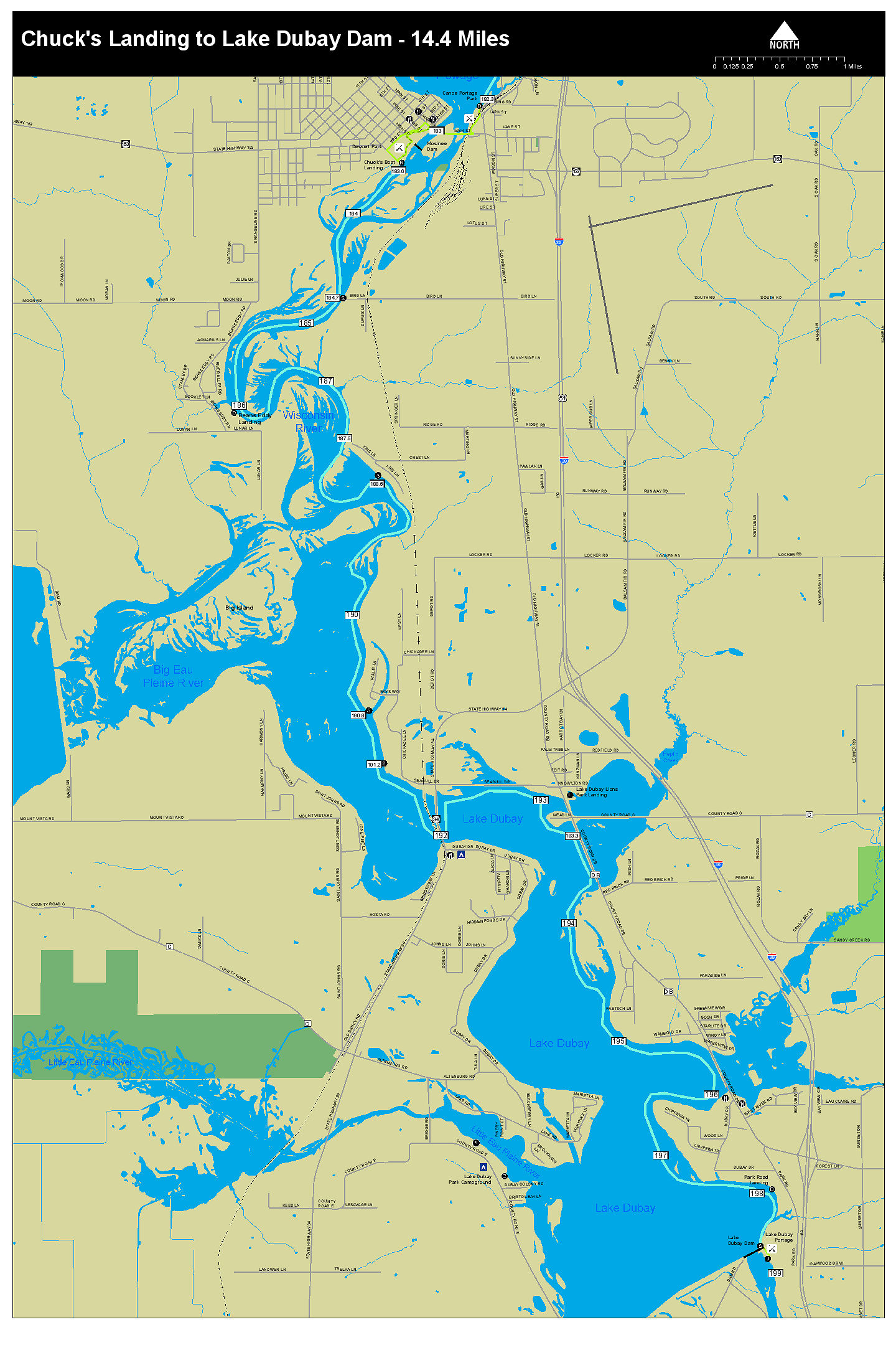
Map 11 Chucks Landing to Lake Du Bay Dam Portage
Map 12 Lower Big Rib River Water Trail
Map 13 Lower Eau Claire River Trail
Paddle Guides
Weather Information
Friends of The Great Pinery Heritage Waterway
Organization Friends
More About The Great Heritage Waterway
Great Pinery Heritage Waterway Home Website


![]()